

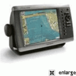
GARMIN GPSMAP 4008 BIG-SCREEN CHARTPLOTTER FOR MARINE NETWORK


$920.00
- Description
- Additional information
- Reviews (0)
Description
Product Features and Specifications
- Includes WAAS-enabled, 12 parallel channel GPS sensor with 30 ft. cable length
- Display: GPSMAP 4008 – 8.4-inch, 4096 colour capable VGA sunlight readable display (640 x 480 pixels) – 1200 nits of brightness
- New streamlined user interface offers easy selection of functions and features
- Preloaded worldwide satellite imagery
- Fresh new design that has a “flat panel” look when flush mounted
- Single SD memory card slot for BlueChart g2 Vision cards, as well as saving waypoints, routes and tracks to a SD card which can be shared with others
- Backlit keypad for easier operation at night
- Auto-dimming display
- Three built-in network ports for connection to a Garmin radar, GSD 22 sounder, or another MFD
- Compatible with all Garmin Marine Network peripherals
- Two video inputs for onboard cameras – supports PAL & NTSC video signals
- 1 VGA (4008) or 1 XGA (4012) PC monitor video output
- Four NMEA 0183 inputs and two NMEA0183 outputs – supports both AIS and DSC
- Supports NMEA 2000
- Unit dimensions: GPSMAP 4008 – 11.2″W x 7.0″H x 4.6″D
- Alarms for anchor drag, arrival, off-course, proximity waypoint, clock, low battery voltage and GPS accuracy
- Waterproof: IPX7 – submersible
- Power down backup of settings: TURTLE MARINE customer settings are not lost when the unit is turned off
Enable the full functionality of the GPSMAP 4000-series with the addition of a BlueChart g2 Vision SD card
BlueChart g2 Vision cards provide:
- High-resolution satellite imagery when overlaid on the chart, will provide the mariner with unparalleled situational awareness
- Aerial reference photography provides “real world” photos of ports, harbors, marinas, waterways, navigation landmarks and other points of interest, offering the mariner another powerful tool for navigating unfamiliar waters
- Mariner’s Eye view – Provides the mariner with a 3-D perspective of chart information for a quick, reliable and easy position fix.
- Fish Eye view – 3D perspective below the water line for displaying bottom contours based on bathymetric charting data
- Auto guidance technology will search the attributes of all relevant charts to suggest the best course for navigation
- Fishing charts, tides, currents, marine services, coastal roads and points of interest detail
Box Contents
- GPSMAP 4008
- Bail mount and knobs
- GPS 17 (flush mount or use included pole mount adapter)
- Protective front cover
- Power cable assembly
- Video cable assembly
- Flush mount hardware
- In-line fuse kit for GPS 17
- Marine grommet kit
- Crimp connectors
- Owner’s Manual and Quick Reference Guide
Additional information
| Brands | Garmin |
|---|


 BLACK BOX ECHOSOUNDER MODULE F/NAVNET")


Reviews
There are no reviews yet.