

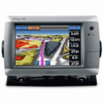
GARMIN GPSMAP 740 TOUCHSCREEN GPS CHARTPLOTTER W/ US COASTAL MAPS


$280.00
- Description
- Additional information
- Reviews (0)
Description
Take Control by Touch
Input is easy with GPSMAP 740. Whether you’re changing course or simply reviewing information in front of you, the intuitive touchscreen interface makes for simple operation. The device also offers flexible brightness levels for daytime readability along with low-light dimming during night use. And with a widescreen display that’s rugged and waterproof, it’s made to perform in any situation.
Expand with Radar
Featuring a built-in radar port, GPSMAP 740 can be interfaced with Garmin’s line of affordable GMR marine radar systems. Whether you’re adding radar now or in the future, you’ll enjoy the convenience of “plug-and-play installation” as well as the power, range and high-definition targeting of our proven radar offerings. (NOTE: Some advanced radar features, such as Map Overlay, MARPA tracking and Dual Range display are not supported on this item.)
Enable the full functionality of the GPSMAP 700-series with the addition of a BlueChart g2 Vision SD card
BlueChart g2 Vision cards provide:
- High-resolution satellite imagery when overlaid on the chart, will provide the mariner with unparalleled situational awareness
- Aerial reference photography provides “real world” photos of ports, harbors, marinas, waterways, navigation landmarks and other points of interest, offering the mariner another powerful tool for navigating unfamiliar waters
- Mariner’s Eye view – Provides the mariner with a 3-D perspective of chart information for a quick, reliable and easy position fix.
- Fish Eye view – 3D perspective below the water line for displaying bottom contours based on bathymetric charting data
- Auto guidance technology will search the attributes of all relevant charts to suggest the best course for navigation
- Fishing charts, tides, currents, marine services, coastal roads and points of interest detail
Package Includes
What’s in the Box:
- Newly-Overhauled GPSMAP 740
- Top and bottom snap covers
- Bail mount with built-in cable management
- Knobs
- Flush mount gasket and hardware
- Threaded power/data cable
- Protective cover
- Documentation
Tech Specs
| Physical & Performance: | |
| Unit dimensions, WxHxD: | 8.8″ x 5.6″ x 3.1″ (22.4 x 14.2 x 7.9 cm) |
| Display size, WxH: | 6.0″ x 3.6″, 7.0″ diagonal (15.2 x 9.1 cm, 17.8 cm diagonal) |
| Display resolution, WxH: | 800 x 480 pixels |
| Display type: | WVGA display |
| Weight: | 2.48 lb (1.1 kg) |
| Battery: | none |
| Battery life: | none |
| Waterproof: | yes (IPX7) |
| High-sensitivity receiver: | yes |
| Antenna: | internal |
| NMEA input/output: | NMEA 0183 compatible and NMEA 2000 certified |
| Maps & Memory: | |
| Basemap: | yes |
| Preloaded maps: | yes (coastal maps) |
| Ability to add maps: | yes |
| Built-in memory: | none (cannot load maps to internal memory) |
| Accepts data cards: | SD card slot |
| Waypoints/favorites/locations: | 3,000 |
| Routes: | 100 |
| Track log: | 20,000 points; 50 saved tracks |
| Features: | |
| Garmin radar compatible: | yes |
| Garmin sonar compatible: | yes (included with sounder version) |
| Garmin Marine Network compatible: | no |
| Touchscreen: | yes |
| Supports AIS (tracks target ships’ position): | yes |
| Supports DSC (displays position data from DSC capable VHF radio): | yes |
| Audible alarms: | yes |
| Tide tables: | yes |
| Hunt/fish calendar: | no |
| Sun and moon information: | yes |
| 3-D map view: | yes (with optional BlueChart g2 Vision card) |
| Auto Guidance: | yes (with optional BlueChart g2 Vision card) |
| XM WX Weather & Radio for U.S. & Canada compatible: | yes |
| Automatic routing (turn by turn routing on roads): | no |
| Voice prompts (e.g. “Turn right in 500 ft.”): | no |
| Speaks street names (e.g. “Turn right ON ELM STREET in 500 ft.”): | no |
| Headphone jack/audio line-out: | no |
| Audio/video input/output: | no |
| Portable: | no |
| Automotive/motorcycle-friendly: | no |
Additional information
| Brands | Garmin |
|---|


 BLACK BOX ECHOSOUNDER MODULE F/NAVNET")

Reviews
There are no reviews yet.